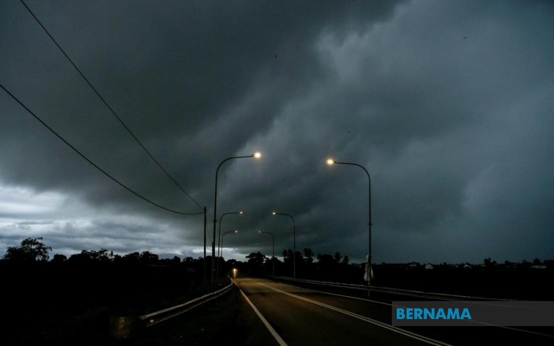
The Malaysian Meteorological Department has activated a weather warning across a broad swathe of the country, alerting residents in nine states and Labuan to prepare for potentially hazardous atmospheric conditions through the evening hours. The alert encompasses thunderstorms, torrential downpours and gusty winds that could impact daily activities and pose risks to communities, particularly in low-lying areas and along waterways.
The warning blankets all of Perlis, a northwestern state particularly vulnerable to seasonal weather patterns. In neighbouring Kedah, the alert focuses on specific districts including the island of Langkawi and several mainland areas such as Kubang Pasu, Kota Setar, Pokok Sena, Padang Terap, Sik and Baling. This targeted geographical approach reflects how thunderstorm activity often develops in isolated clusters rather than affecting entire states uniformly.
Perak, another major northern state, faces similar conditions across the districts of Kerian, Larut, Matang and Selama, as well as Kuala Kangsar, Kinta and Kampar. These regions, which include both lowland areas and zones near the Titiwangsa Range, frequently experience convective weather systems that develop when warm, moisture-laden air rises rapidly over elevated terrain.
Moving eastward, Pahang's Cameron Highlands, Bentong, Bera and Rompin districts are under alert, with the highland regions particularly susceptible to sudden atmospheric disturbances. In the Klang Valley region, Selangor's Hulu Langat district faces warnings, while Negeri Sembilan's Jelebu and Jempol areas are similarly affected. Johor's southern districts of Segamat, Kluang and Mersing round out the Peninsular Malaysia coverage, reflecting the comprehensive nature of this weather system.
East Malaysia faces even more extensive impacts. In Sarawak, a vast territorial expanse, multiple divisions are under alert including the state capital's surroundings in Kuching, the districts of Bau and urban Kuching itself, alongside Serian, Samarahan with its subdivisions Samarahan and Asajaya, Sarikei's Meradong area, Sibu, Mukah's Tanjung Manis, Kapit with Song and Kapit proper, Bintulu's Tatau and Sebauh regions, Miri's Marudi district and Limbang. This extensive coverage suggests a major weather system affecting the entire state.
Sabah, positioned on the northern tip of Borneo, experiences the alert across multiple zones including interior regions of Sipitang, Kuala Penyu, Beaufort and Tambunan, alongside the vulnerable west coast and Sandakan's eastern districts of Tongod and Kinabatangan. The interior districts are particularly significant as they encompass mountainous terrain where flash flooding and landslides pose genuine hazards during intense precipitation events.
Thunderstorms during Malaysia's monsoon transitions can develop with remarkable speed and intensity. When atmospheric conditions align—with sufficient moisture, instability and a triggering mechanism such as sea breeze convergence or orographic lifting—individual thundercells can produce rainfall rates exceeding 100mm per hour. Such precipitation levels overwhelm drainage systems and pose serious flood risks, particularly in urban areas with inadequate stormwater management and rural regions with poor infrastructure.
Residents in affected areas should exercise heightened caution during the warning period, which extends until 9 pm. Drivers should avoid unnecessary travel, particularly through flood-prone routes and areas beneath power lines vulnerable to lightning strikes. Boaters and those engaged in water-based activities face heightened danger from sudden squalls and rough conditions. Construction sites and outdoor events may require temporary suspension of operations to protect personnel from lightning hazards.
The alert underscores the importance of staying informed through MetMalaysia's updates and official emergency channels. Mobile phone alerts, weather apps and local media provide real-time information as conditions develop. For communities in previously flood-affected areas, this warning represents another opportunity to test preparedness systems and ensure residents understand evacuation routes and assembly points. History demonstrates that early action and public awareness significantly reduce casualties and economic losses when severe weather strikes.
MetMalaysia's forecast methodology relies on satellite imagery, radar data and atmospheric modelling to track developing storm systems. The specificity of district-level warnings reflects advances in weather prediction technology, enabling authorities to target alerts more precisely than broader state-wide announcements. However, thunderstorm intensity and exact location remain inherently difficult to predict beyond a few hours, making real-time monitoring essential as the evening approaches.
Beyond immediate precautions, this weather event contributes to Malaysia's annual rainfall patterns and hydrological cycle. For water-dependent sectors including agriculture and hydroelectric generation, such precipitation events, while disruptive in the short term, represent crucial water inputs. The timing and intensity of these storms throughout the year directly influence reservoir levels, irrigation availability and power generation capacity, making weather monitoring integral to resource management planning across the region.